Operative Image
A design assignment for Intro to Urban Design Media Fall 2020 (Master of Urban Design Program at Carnegie Mellon University)
Project: Operative Image (breakdown one system into parts and reassemble)
Studio Instructor: Heather Bizon
.jpg)
Operative Image
A design assignment for Intro to Urban Design Media Fall 2020 (Master of Urban Design Program at Carnegie Mellon University)
Project: Operative Image (breakdown one system into parts and reassemble)
Studio Instructor: Heather Bizon
Operative Image
A design assignment for Intro to Urban Design Media Fall 2020 (Master of Urban Design Program at Carnegie Mellon University)
Project: Operative Image (breakdown one system into parts and reassemble)
Studio Instructor: Heather Bizon
Operative Image
A design assignment for Intro to Urban Design Media Fall 2020 (Master of Urban Design Program at Carnegie Mellon University)
Project: Operative Image (breakdown one system into parts and reassemble)
Studio Instructor: Heather Bizon
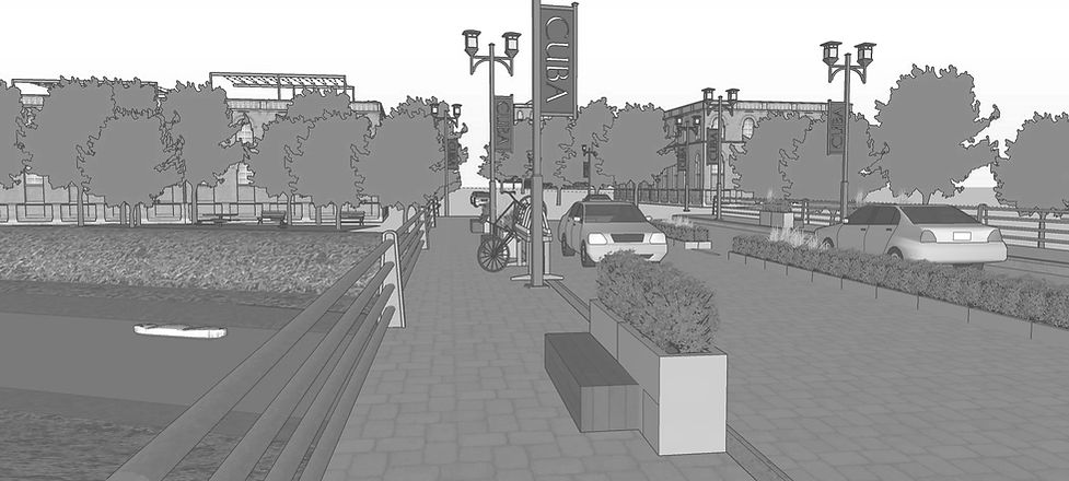
Illustration
drawings created for Urban Places Studio Fall 2020 (Master of Urban Design Program at Carnegie Mellon University)
Semester Project: Netzero Montpelier
Studio Instructor: Stafeni Danes
Rendering Workshop Instructor: Joe Skibba
Operative Image
A design assignment for Intro to Urban Design Media Fall 2020 (Master of Urban Design Program at Carnegie Mellon University)
Project: Operative Image (breakdown one system into parts and reassemble)
Studio Instructor: Heather Bizon
a landscape architecture and urban design student, who is passionate about creating memorable places
Reimagining Mobility |
Connecting People, Places, and Pollinators
Full
Report

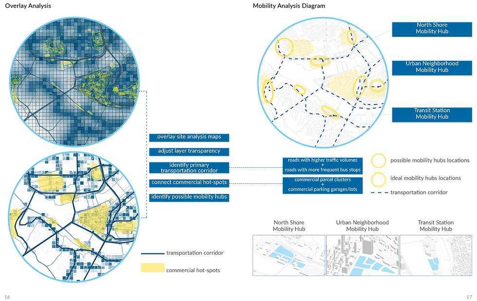
Objective: This project aims to make the most effective use of the city’s land resources, design environmentally-friendly mobility hubs and transportation corridors, and propose a pollinator habitat plan in downtown Pittsburgh. Currently, the downtown area has many vacant parcels and parking lots with impervious surfaces. These disused and underutilized spaces can be transformed into mobility hubs, green parking lots, and pollinator habitats.
Course: Urban Design Computation, Srping 2021 (Individual Work)
Process: ArcGIS Data Collection -> Mobility System Analysis -> Component Design -> Simulation -> Evaluate Simulation Performances
Software Used: ArcGIS, Rhino, Grasshopper, Sketchup, AutoCAD, InDesign, Photoshop
DESIGN OBJECTIVE - Urban Intervention
1. Making the most efficient use of the space
Repurposing the use of current vacant commercial parcels and parking lots to reduce the percentage of impervious surfaces in downtown Pittsburgh radically
2. Improving street tree planting strategies
Proposing a new street tree planting guide based on three street typologies - transportation corridor street, commercial street and residential street
3. Creating a network of pollinator habitats
Promoting and connecting healthy pollinator habitats in downtown Pittsburgh